
SHYDRO2GEO-Spatialisation of Hydrological parameters using geophysical and geostatistical methods
Research on the Critical Zone (CZ) is a prerequisite for undertaking issues related to exosystemic services that human societies rely on (nutrient cycles, water supply and quality). However, while the upper part of CZ (vegetation, soil, surface water) is readily accessible, knowledge of the subsurface remains limited, due to the point-scale character of conventional direct observations. While the potential for geophysical methods to overcome this limitation is recognized, the translation of the geophysical information into physical properties or states of interest remains a challenge (e.g. the translation of soil electrical resistivity into soil water content).
In this study, we propose a geostatistical framework using the Bayesian Maximum Entropy (BME) approach to assimilate geophysical and point-scale data. We especially focus on the prediction of the spatial distribution of soil water content using (1) TDR point-scale measurements of soil water content, which are considered as accurate data, and (2) soil water content data derived from electrical resistivity measurements, which are uncertain data but spatially dense.
During 2 years, we have regularly used Syscal Pro Critex resistivitimeter (ERT, task 6.3) to carry out a time-lapse monitoring (with high frequency) on the watershed of the Orgeval (ORACLE observatory, Ile-de-France), we have acquired 600 panels of electrical resistivity (which could not have been possible without this equipment). This data set allows us today, a fine characterization of the phenomena of infiltration by the analysis of the data and the application of the framework of geostatistics on experimental data from 2015-2016. The results obtained with the BME are satisfying and robust.
-
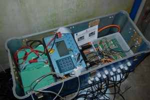
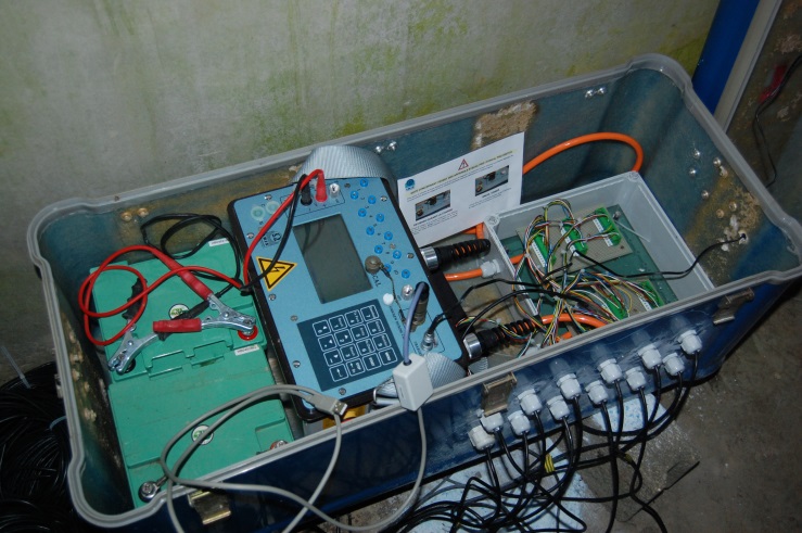
- Electrical resistivitimeter
-
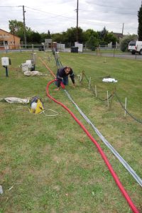
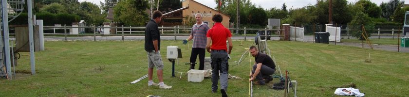
- Installation of Critex resistivitimeter on Orgeval Water catchment (RBV observatory), electrical resistivitimeter (on the left), installation of electrodes (on the right)
