
SWIP: An integrated workflow for surface-wave dispersion inversion and profiling
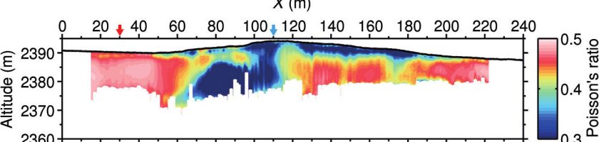
The simultaneous estimation of 2D pressure (P-) and S-wave velocities (VP and VS, respectively) is a promising approach for imaging subsurface mechanical properties. It can be performed with a single acquisition setup by combining P-wave refraction and surface-wave (SW) analysis. Although SW methods are commonly applied for the 1D estimation of VS, 2D profiling requires the implementation of specific processing […]
Read more