Tag Archives: Hydrogéologie

Installation d’un gravimètre supraconducteur sur le site du Strengbach (OHGE)

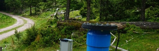
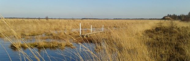
03 juillet 2017 Un gravimètre supraconducteur de nouvelle génération a été installé par l’équipe de gravimétrie de l’EOST/IPG Strasbourg dans un bâtiment de l’antenne TDF sur la partie sommitale du bassin versant du Strengbach dans les Vosges (Observatoire HydroGéochimique de l’Environnement, OHGE). Cet instrument est l’un des trois gravimètres supraconducteurs acquis dans le cadre du projet d’Excellence CRITEX (Etude de […]

Read more

Neutrally buoyant tracers in hydrogeophysics: Field demonstration in fractured rock

Electrical and electromagnetic methods are extensively used to map electrically conductive tracers within hydrogeologic systems. Often, the tracers used consist of dissolved salt in water, leading to a denser mixture than the ambient formation water. Density effects are often ignored and rarely modeled but can dramatically affect transport behavior and introduce dynamics that are unrepresentative of the response obtained with […]

Read more

Passive temperature tomography experiments to characterize transmissivity and connectivity of preferential flow paths in fractured media

The detection of preferential flow paths and the characterization of their hydraulic properties are major challenges in fractured rock hydrology. In this study, we propose to use temperature as a passive tracer to characterize fracture connectivity and hydraulic properties. In particular, we propose a new temperature tomography field method in which borehole temperature profiles are measured under different pumping conditions […]

Read more

pyGrav, a Python-based program for handling and processing relative gravity data

Papers - Publications scientifiques

pyGrav is a Python-based open-source software dedicated to the complete processing of relative-gravity data. It is particularly suited for time-lapse gravity surveys where high precision is sought. Its purpose is to bind together single-task processing codes in a user friendly interface for handy and fast treatment of raw gravity data from many stations of a network. The intuitive object-based implementation […]

Read more

CRITEX, Guide de la R&D, 2016

CRITEX est un projet financé par le Programme d’Investissements d’Avenir visant le développement de capteurs pour l’étude de la zone critique de la Terre, c’est à dire cette zone comprise entre le ciel et les profondeurs de la Terre sur laquelle l’humanité vit, dont elle se nourrit et où elle stocke ses déchets. Ce programme associe plusieurs organismes de recherche […]

Read more

Une zone si critique

L’humanité se rassemble sur une fine pellicule de la planète qui va des sols à la basse atmosphère et inclut tout le vivant : un espace pour notre survie qui ne se laisse pas étudier si facilement. Spécialistes en géosciences, Nicolas Arnaud et Jérôme Gaillardet nous en disent plus sur ce que l’on appelle la « zone critique ». Copyright […]

Read more

Distributed Temperature Sensing as a down-hole tool in hydrogeology

Papers - Publications scientifiques

Distributed Temperature Sensing (DTS) technology enables down-hole temperature monitoring to study hydrogeological processes at unprecedentedly high frequency and spatial resolution. DTS has been widely applied in passive mode in site investigations of groundwater ow, in-well flow, and subsurface thermal property estimation. However, recent years have seen the further development of the use of DTS in an active mode (A-DTS) for which heat sources are deployed. […]

Read more

3ème Workshop sur l’Hydrogéophysique AGU-SEG : Imager de la Zone Critique

 Le 3ème worksjop d’hydrogéophysique de l’AGU et la SEG – imager la Zone Critique – aura lieu à Stanford, California du 24 au 27 juillet 2017. Dans ce workshop, les organisateurs proposent de développer un cadre pour faire avancer à la fois l’hydrogéophysique et les recherches sur la Zone Critique, par une coordination des agendas. Les méthodes d’hydrogéophysique permettront de […]

Read more

Presentation of a Complex Permittivity-Meter with Applications for Sensing the Moisture and Salinity of a Porous Media

Papers - Publications scientifiques

This paper describes a sensor dedicated to measuring the vertical profile of the complex permittivity and the temperature of any medium in which sensor electrodes are inserted. Potential applications are the estimate of the humidity and salinity in a porous medium, such as a soil. It consists of vertically-stacked capacitors along two conductive parallel cylinders of 5 cm in diameter and at a 10-cm […]

Read more

Hydrogeophysical characterization of transport processes in fractured rock by combining push-pull and single-hole ground penetrating radar experiments

The in situ characterization of transport processes in fractured media is particularly challenging due to the considerable spatial uncertainty on tracer pathways and dominant controlling processes, such as dispersion, channeling, trapping, matrix diffusion, ambient and density driven flows. We attempted to reduce this uncertainty by coupling push-pull tracer experiments with single-hole ground penetrating radar (GPR) time-lapse imaging. The experiments involved different injection fractures, chaser […]

Read more
1 2